Red River
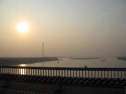
The Red River is the second largest river of Vietnam after Mekong. It descends from Yunnan, a mountainous region south of China. It is known as the "six-head river" that enters Vietnam definitively at Lao Cai. It curves on more than 1000km ( over 600 miles ) before dying in the somptuous bay of Hạ Long.
The Red River delta is the hub of all economic activity in the north of Vietnam, where the majority of the region's population is concentrated. The delta, which supports nearly half the country's rice production, is under threat due to its strategic position and unchecked population growth that is putting an increasing strain on resources. Food production is endangered by periodic flooding and environmental degradation caused by intensive farming methods designed to increase crop yields. Vietnamese planners are using satellite imagery to model and monitor change in an effort to solve the delta's problems.
Deforestation in the hills surrounding the Red River delta is leading to increased erosion, which in turn is causing more solid matter to be washed down to the delta. Alluvium that would otherwise provide rich nutrients for delta soils is blocked by levees built in the 18th century. And tectonic activity is causing basins barely four to five metres above sea level but as far as 60 kilometres inland to become permanently water-logged.
The rice harvest during the second half of the year is vital to food production in the delta. This period is invariably preceded by flooding that poses a serious threat not only to agriculture but also to the economy in general. One of the effects of new free-market policies has been to increase crop yields through intensive farming practices, which only degrade the environment further. Population densities exceed 1 000 inhabitants per square kilometre in the major cities of Hanoi and Haiphong in the north of the country.
Tin tức liên quan
- Vietnamese second most confident in Asia-Pacific about post-pandemic travel: survey (24/6/2022)
- Kayaking in Việt Nam’s most beautiful places (24/04/2021)
- Da Nang tops Google list of 10 trending destinations for 2020
- Explore Vân Long Wetland Nature Reserve in Ninh Bình
- Hà Nội Train Street among Top 8 over-touristed sites (03/12/2019)
- VNAT hosts famtrip to explore sea and island tourism products in Quang Nam and Quang Ngai
- Travel Daily News lists amazing ways to see Viet Nam (21/06/2019)
- Ha Noi serves nearly 14.4 million visitors so far (21/06/2019)
- CNN praises Hoi An as one of the most beautiful towns in Southeast Asia (19/06/2019)
- Quang Ninh has additional sea and island tourism site (14/06/2019)
Tìm kiếm
Tour
Hotel
Keyword
Location
Location
Star
Type